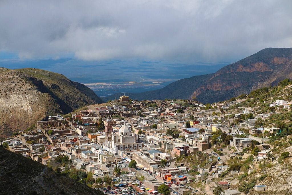
High in the dry mountains of central Mexico, a stone town clings to a steep slope above the desert. To reach it, you drive through a long, narrow tunnel carved out by silver miners more than a century ago. This is Real de Catorce, a former boomtown that today feels half alive and half ghost town. In this guide, you will discover what to see, how to get there and when to visit.
Quick Facts About Real de Catorce, Mexico
| Country | Mexico |
| Region | San Luis Potosí, Sierra de Catorce |
| Known For | Silver mining history, the Ogarrio Tunnel, ghost town ruins and pilgrimages |
| UNESCO Status | Not listed (nearby Cerro Quemado is a protected sacred site) |
| Founded | 1779 |
| Best Time to Visit | October to April |
| Time Needed | Two days |
| Continent | North America |
Where Is Real de Catorce, Mexico?
Real de Catorce lies in the state of San Luis Potosí, in north-central Mexico. In fact, it sits on a mountainside in the Sierra de Catorce, about 260 kilometers north of the city of San Luis Potosí.
Specifically, the town stands at around 2,728 meters above sea level. As a result, the air is thin and cool, and the views over the desert plateau are vast.
Why Visit Real de Catorce, Mexico?
First of all, Real de Catorce is wonderfully atmospheric. Indeed, its stone streets, crumbling mansions and empty ruins tell the story of a silver boom and bust.
In addition, the journey itself is an adventure. Indeed, entering the town through a long mining tunnel is unforgettable.
Finally, the town has deep spiritual importance. For example, Catholic pilgrims and Huichol people both consider the area sacred. Moreover, Real de Catorce was named a Pueblo Mágico in 2001.
Exploring the Town of Real de Catorce
The town is small and best explored on foot. However, the streets are steep and cobbled, so wear good shoes.
The Ogarrio Tunnel
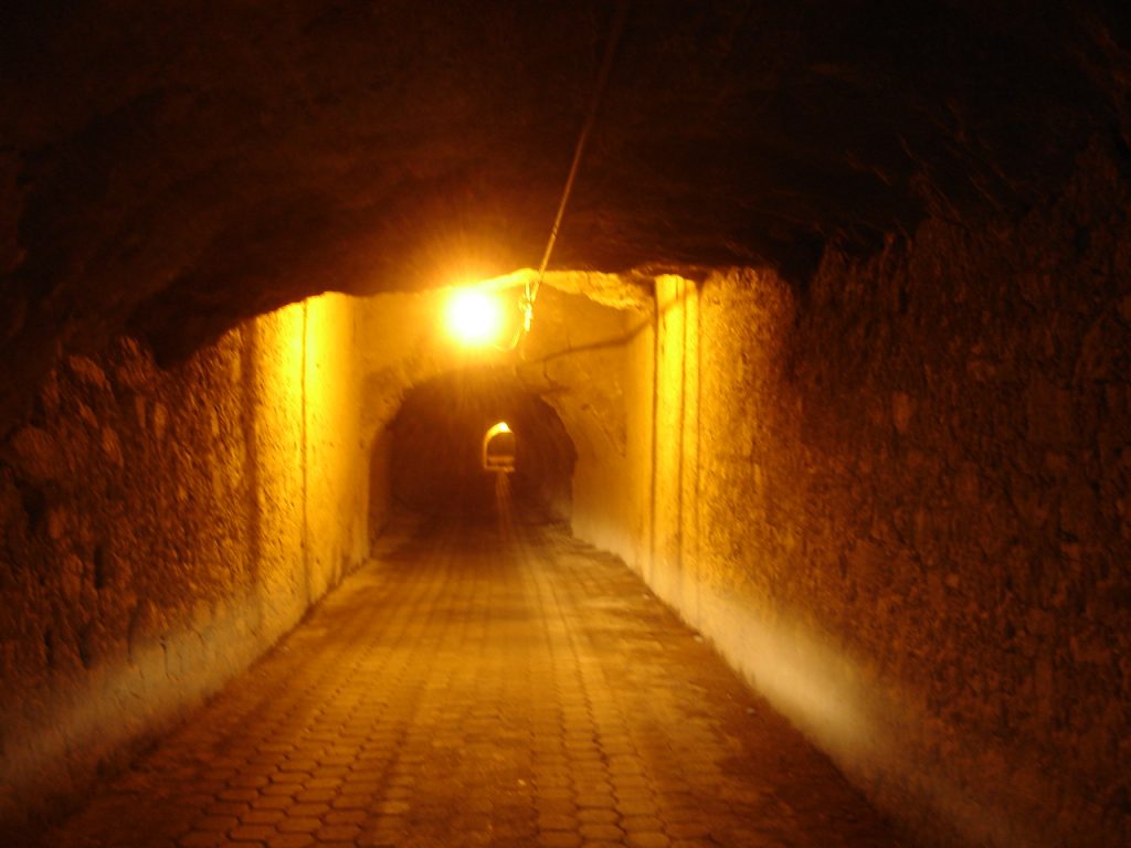
The Ogarrio Tunnel is the main entrance to town. In fact, it is about 2.4 kilometers long and allows only one-way traffic at a time. Consequently, cars wait at each end for their turn.
Stone Streets and Old Mansions
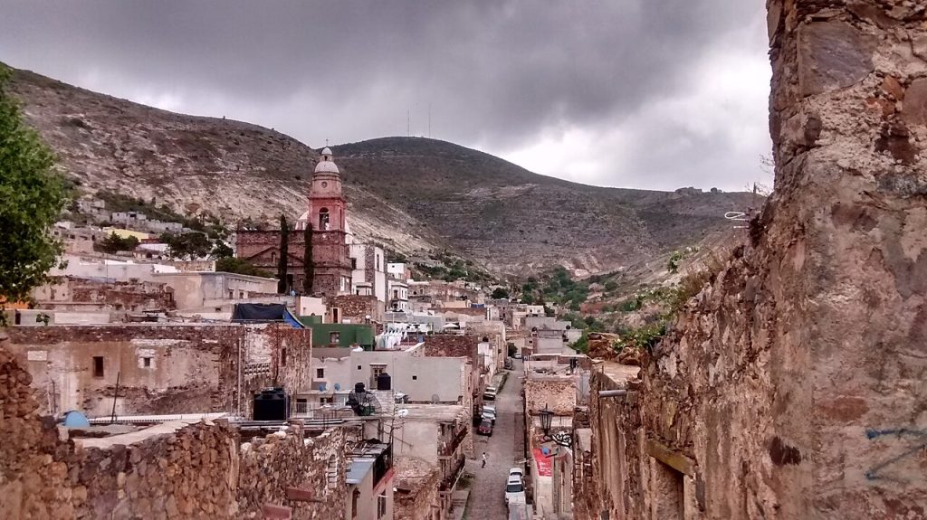
Meanwhile, inside the town, cobbled streets wind between old stone houses and the remains of grand mansions. Many buildings date from the silver boom, while others stand roofless and abandoned.
The Parish of the Immaculate Conception
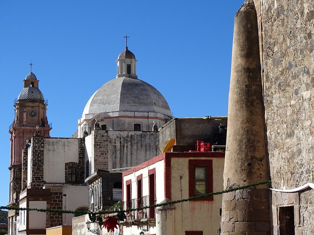
The Parish of the Immaculate Conception is the spiritual heart of town. Every year, around 4 October, thousands of pilgrims arrive for the feast of St Francis of Assisi. Therefore, the town is especially lively at this time.
The Ghost Town and Surroundings
Above and around the town, the ruins of the mining era are scattered across the hills.
Pueblo Fantasma
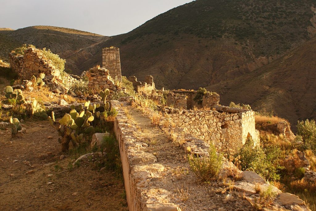
The ghost town, or Pueblo Fantasma, lies on the slopes above Real de Catorce. Here, roofless stone buildings and old mine works still stand in silence. In particular, the views from up here are spectacular.
Desert Ruins
Beyond the town, ruined churches and buildings stand in the desert hills. Today, many visitors also explore them on horseback or by jeep tour.

Wirikuta and Cerro Quemado
The desert below the town, called Wirikuta, is sacred to the Huichol, or Wixárika, people. They make ceremonial pilgrimages to Cerro Quemado, which UNESCO recognized as a protected area in 2000.
Respecting Sacred Land
Since this is a sacred landscape, treat it with respect. Importantly, only Huichol people may legally gather peyote here.
Protecting Wirikuta
In 2013, federal courts suspended mining plans across a large part of Wirikuta. As a result, the area remains an important cultural and natural landscape.
One Historical Fact About Real de Catorce, Mexico
Silver was discovered here in 1772, and the town was officially founded in 1779. By the late 19th century, it had around 15,000 residents. However, after silver prices fell following 1900, the town was almost completely abandoned. Interestingly, its name is said to come from 14 Spanish soldiers killed in an ambush.
How to Get to Real de Catorce, Mexico
In general, the town is reached by road from Highway 62, between Matehuala and San Tiburcio.
- By car: A 27-kilometer cobblestone road leads from the highway to the Ogarrio Tunnel.
- By bus: Buses run to the area from Matehuala and other cities in the region.
- Through the tunnel: At the end of the road, the one-way tunnel leads into town.
Best Time to Visit Real de Catorce, Mexico
The dry months, from October to April, are generally the best time to visit. During these months, the skies are clear and walking is pleasant. However, nights can be very cold at this altitude.
Around 4 October, the pilgrimage fills the town with visitors. In contrast, summer brings warmer days and occasional rain.
Is Real de Catorce, Mexico Worth Visiting?
Yes, absolutely. Overall, Real de Catorce combines a dramatic mountain setting, a fascinating mining history and a strong spiritual atmosphere. Moreover, few places in Mexico feel quite so remote.
For travelers who love history and adventure, it is a perfect choice. Therefore, plan to stay at least one night.
Final Thoughts
Real de Catorce is a town of silver, stone and silence. Drive through the Ogarrio Tunnel, wander the cobbled streets and climb to the ghost town for the view. Above all, respect the sacred landscape around you. If you love historic towns in Mexico, you may also enjoy our guides to Taxco and San Miguel de Allende.
Image Credits
Wikimedia Commons
- Panorama of the Town: Photo by Rafael Saldaña via Wikimedia Commons (CC BY 2.0)
- Town and Mountains: Photo by Balaenicactus via Wikimedia Commons (CC BY-SA 4.0)
- Parish of the Immaculate Conception: Photo by Adam Jones via Wikimedia Commons (CC BY-SA 2.0)
- Inside the Ogarrio Tunnel: Photo by verdo_iglesias via Wikimedia Commons (CC BY-SA 3.0)
- Pueblo Fantasma: Photo by JimenaMrtnz via Wikimedia Commons (CC BY-SA 4.0)
- Church Ruins Outside Town: Photo by Adam Jones via Wikimedia Commons (CC BY-SA 2.0)