In the highlands of Bahia, a small colonial town sits beside a rushing river, surrounded by flat-topped mountains and deep canyons. Once, it was the center of a great diamond rush, and today it is the gateway to some of Brazil’s most spectacular scenery. This is Lençóis, the heart of Chapada Diamantina. In this guide, you will learn what to see, how to get there and when to visit.
Quick Facts About Lençóis, Brazil
| Country | Brazil |
| Region | Bahia, Chapada Diamantina |
| Known For | Colonial architecture, diamond history and access to Chapada Diamantina National Park |
| UNESCO Status | Not listed (the historic center is a national heritage site) |
| Founded | 1845 |
| Best Time to Visit | April to October |
| Time Needed | Three to five days |
| Continent | South America |
Where Is Lençóis, Brazil?
Lençóis lies in the state of Bahia, in northeastern Brazil, in the Chapada Diamantina highlands. In fact, it sits about 420 kilometers from Salvador, the state capital.
Moreover, the town stands on the edge of Chapada Diamantina National Park, created in 1985. As a result, it is the main starting point for treks into the region.
Why Visit Lençóis, Brazil?
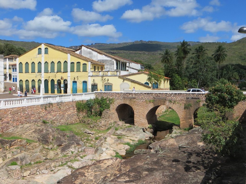
First of all, Lençóis is a charming colonial town. Its historic center has about 570 properties, mostly 19th-century houses built of adobe and stone. Therefore, simply walking its streets is a pleasure.
In addition, the town is surrounded by incredible nature. For example, mountains, canyons, caves, rivers and waterfalls lie within easy reach.
Finally, Lençóis has a rich history. Indeed, in the second half of the 19th century, this region was the world’s largest producer of diamonds.
Exploring the Town of Lençóis
The town center is compact and easy to explore on foot. Above all, take your time to enjoy the colorful facades and riverside views.
The Historic Center
In 1973, Brazil’s national heritage agency, IPHAN, protected the town’s architecture and landscape. Today, cobbled streets lead past colorful houses, small squares and old churches.
The River
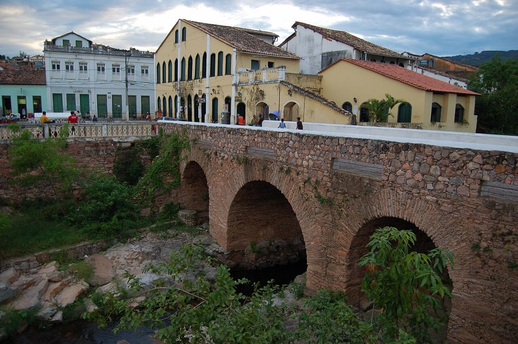
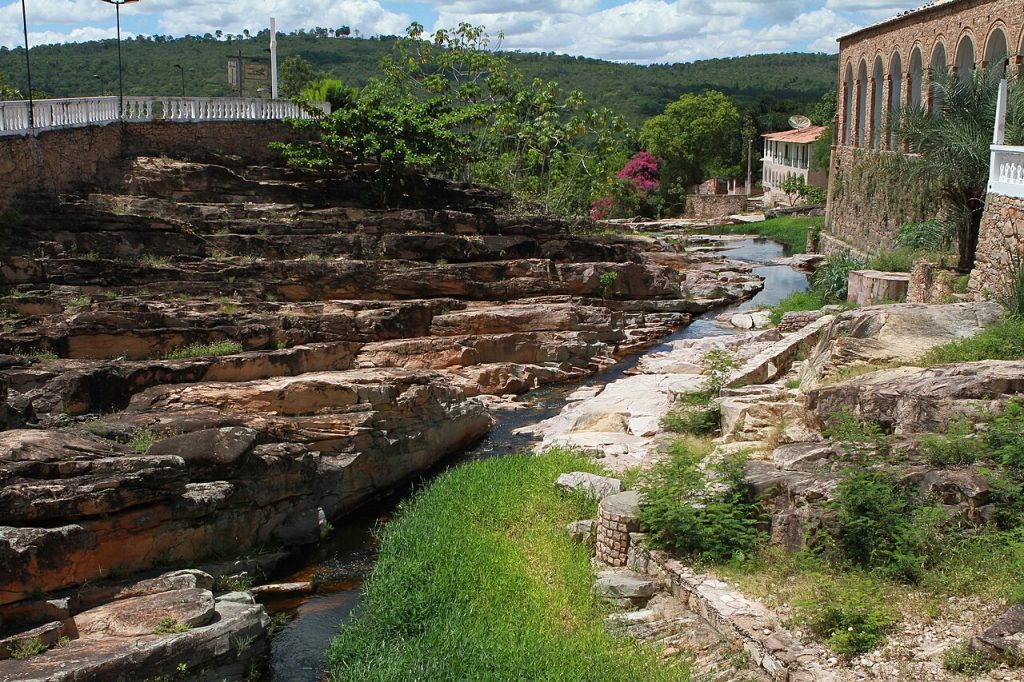
The Lençóis River flows right through town, crossed by old stone bridges. Along its banks, smooth rocks and small pools also make a lovely spot to relax.
Evenings in Town
In the evening, the town comes alive. For example, restaurants and bars set up tables in the streets, and travelers gather after a day of hiking.
Chapada Diamantina National Park
Chapada Diamantina National Park covers more than 152,000 hectares. In particular, its rugged plateau is full of mountains, canyons and cave systems carved by rivers. Consequently, it is one of Brazil’s best hiking destinations.
Morro do Pai Inácio
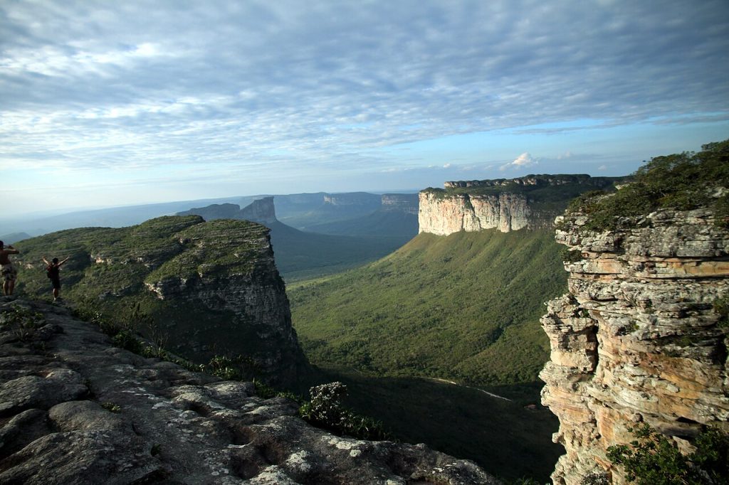
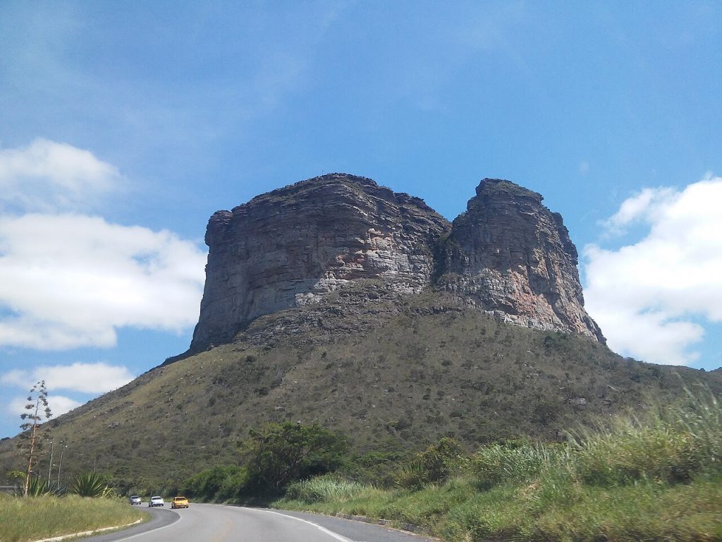
Morro do Pai Inácio is one of the most famous viewpoints in the region. In fact, an easy trail with handrails leads to the top, at about 1,150 meters. In particular, it is a favorite spot for sunset.
Cachoeira da Fumaça
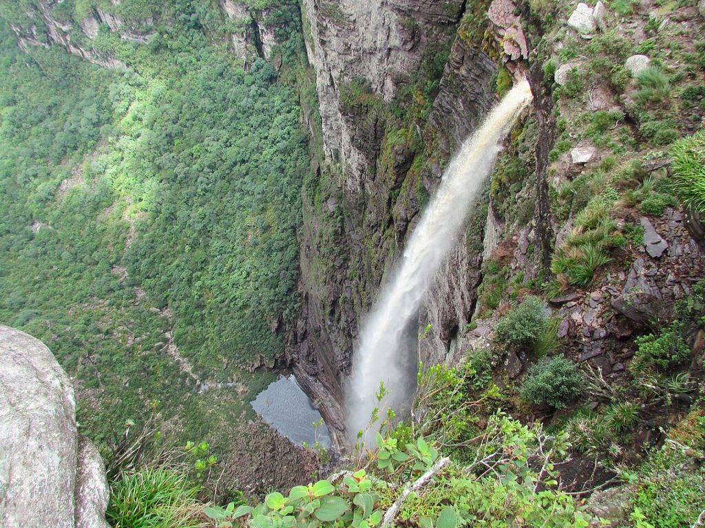
Cachoeira da Fumaça, or Smoke Falls, has a free fall of about 384 meters. In dry weather, the wind often blows the water into mist before it reaches the bottom.
Poço Encantado
Meanwhile, Poço Encantado is a famous cave pool with crystal-clear water. At certain times, sunlight shines through an opening and creates a beam of blue light on the water.
Swimming Spots Near Town
In addition, several natural pools lie within walking distance of Lençóis.
Serrano
Serrano is a site of cascading rock pools near town. Nearby, a cave of colored sands adds to the interest.
Ribeirão do Meio
Ribeirão do Meio is the starting point for a demanding trail of about an hour to Cachoeira do Sossego. Along the way, you will cross rocky riverbeds.
One Historical Fact About Lençóis, Brazil
Lençóis was founded in 1845 by prospectors searching for diamonds. In fact, the town grew so rich that it became Bahia’s third most important city, and a French vice-consulate opened to support trade. Interestingly, one theory says the name comes from miners’ white tents, which looked like sheets from a distance.
How to Get to Lençóis, Brazil
In general, most travelers come from Salvador.
- By bus: Buses run from Salvador to Lençóis, covering about 420 kilometers.
- By car: Driving is recommended, since it lets you reach trailheads around the park.
- By air: Horácio de Mattos Airport serves the town, although flights are limited.
Best Time to Visit Lençóis, Brazil
The best time to visit is from April to October, during the drier season. During these months, trails are easier and safer to walk.
In contrast, the rainy season brings slippery trails and high water. However, waterfalls are at their most powerful after the rains.
Is Lençóis, Brazil Worth Visiting?
Yes, absolutely. Overall, Lençóis combines a charming colonial town with some of the most spectacular landscapes in Brazil. Moreover, it is the perfect base for exploring Chapada Diamantina.
For nature lovers and hikers, it is a dream destination. Therefore, plan at least three days to enjoy it fully.
Final Thoughts
Lençóis is a town of diamonds, rivers and mountains. Wander the colonial streets, watch the sunset from Morro do Pai Inácio and hike to the great waterfalls. Above all, take your time to explore the wild beauty around you. If you love colonial towns in Brazil, you may also enjoy our guides to Ouro Preto and Tiradentes.
Planning a longer trip? You can also pair this visit with our guides to Olinda, Ouro Preto and Tiradentes.
Image Credits
Wikimedia Commons
- Colonial Houses and Bridge: Photo by Just a Brazilian man from São Paulo via Wikimedia Commons (CC BY 2.0)
- Rock Pools Near Town: Photo by Turismo Bahia via Wikimedia Commons (CC BY-SA 2.0)
- Morro do Pai Inácio: Photo by Anne Moraes via Wikimedia Commons (CC BY-SA 3.0)
- Valley in Chapada Diamantina: Photo by Rodolfo Bazetto via Wikimedia Commons (CC BY-SA 4.0)
- Cachoeira da Fumaça: Photo by Conrado Estevão via Wikimedia Commons (CC BY-SA 3.0)
- Stone Bridge: Photo by Patricia Silva via Wikimedia Commons (CC BY 2.0)